Delhi Heatwave May 2026: IMD Alert Status, 7-Day City-Wise Forecast, AQI and Monsoon Countdown
TLDR: Quick Take
- Delhi has an IMD orange alert on May 4, 2026 for thunderstorms, lightning and strong winds.
- Temporary relief from a heatwave that pushed temperatures to 41°C to 46°C in recent days.
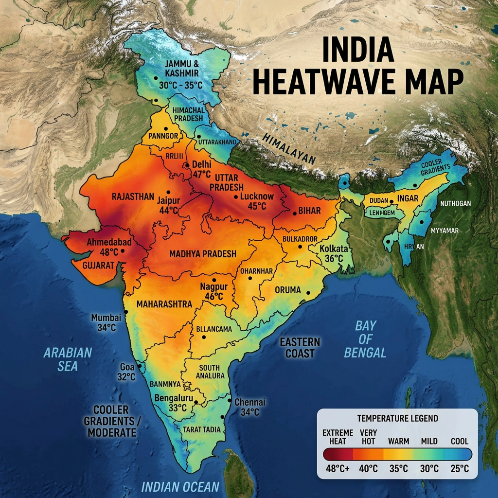
- Rajasthan remains the most extreme heat zone in India with Jaisalmer recording 46.4°C, Kota at 45.7°C and Bikaner at 44°C with a feels-like temperature of 46°C.
- Bangalore is under a yellow alert for heavy rain and winds up to 60 km/h.
- Delhi’s AQI stands at 116 to 163 in the Moderate to Unhealthy range.
- Monsoon onset over the Andaman and Nicobar Islands is expected May 14 to 16.
What to Expect This Week: India Weather Outlook May 4 to 10 2026
This week India’s weather follows two distinct tracks running simultaneously. Delhi and north India get a brief but meaningful cooldown from May 4 to 7 as the current Western Disturbance pushes rain and storms through the region, dropping temperatures from 41°C to around 30°C to 34°C. From May 8 to 10, the heat starts building again toward 37°C to 38°C as the disturbance exits east and dry conditions return. Rajasthan and Gujarat see no such relief and will remain at 42°C to 46°C through the entire week. Bangalore stays rainy and pleasant all week with temperatures holding around 28°C to 32°C. Chennai, Mumbai and Hyderabad remain in the hot and humid range with little change day to day. Kolkata continues to see thunderstorm activity driven by Bay of Bengal moisture. The monsoon countdown continues: 10 to 12 days to Andaman onset, approximately 28 days to Kerala and around 55 days to Delhi.
7-Day City-Wise Forecast Table: May 4 to May 10 2026
| Date | Delhi | Mumbai | Bangalore | Chennai | Hyderabad | Kolkata | Ahmedabad |
| May 4 (Mon) | 37-41°C, thunderstorm | 30°C, humid, light rain | 28°C, heavy rain | 34°C, hot humid | 43°C, dry, eve storms | 36°C, thunderstorm | 43°C, heatwave |
| May 5 (Tue) | 30-31°C, rain | 30°C, humid, cloudy | 28°C, showers | 35°C, hot humid | 41°C, partly cloudy | 35°C, rain | 43°C, heatwave |
| May 6 (Wed) | 30-31°C, rain | 31°C, humid | 29°C, showers | 35°C, hot humid | 40°C, partly cloudy | 35°C, cloudy | 42°C, heatwave |
| May 7 (Thu) | 33°C, patchy rain | 31°C, partly cloudy | 30°C, cloudy, shower | 36°C, hot | 41°C, sunny | 36°C, partly cloudy | 43°C, heatwave |
| May 8 (Fri) | 34-35°C, patchy rain | 32°C, humid | 30°C, partly cloudy | 36°C, hot humid | 42°C, sunny | 36°C, partly cloudy | 43°C, heatwave |
| May 9 (Sat) | 35-37°C, sunny | 32°C, humid | 30°C, sunny | 36°C, hot | 42°C, sunny | 37°C, sunny | 44°C, heatwave |
| May 10 (Sun) | 37-38°C, sunny | 33°C, pre-monsoon humid | 31°C, partly cloudy | 37°C, hot | 43°C, sunny | 37°C, sunny | 44°C, heatwave |
Key pattern: Delhi’s relief window is May 4 to 7. Heat returns from May 8 onward. Rajasthan and Ahmedabad get no meaningful relief this week. Bangalore is the most liveable major city in India through this entire period.
City-Wise Weather Forecast and Temperature Table for May 4 2026
| City | Max Temp | Min Temp | Feels Like | Condition | IMD Alert |
| Delhi | 37-41°C | 23-31°C | 31°C | Thunderstorm, rain | Orange alert |
| Jaisalmer | 45°C | 28°C | 47°C | Severe heatwave | Heatwave alert |
| Bikaner | 44°C | 30°C | 46°C | Severe heatwave, dry | Heatwave alert |
| Kota | 44°C | 29°C | 46°C | Severe heatwave | Heatwave alert |
| Jodhpur | 43°C | 27°C | 37°C | Hot, sunny, dry | Heatwave alert |
| Jaipur | 42-44°C | 27°C | 44°C | Heatwave, dusty winds | Heatwave alert |
| Ahmedabad | 43°C | 28°C | 45°C | Severe heatwave | Heatwave alert |
| Hyderabad | 43°C | 27°C | 44°C | Hot, dry, evening storms | Heat advisory |
| Nagpur | 43°C | 28°C | 44°C | Extreme heat | Heatwave alert |
| Kolkata | 36°C | 27°C | 39°C | Thunderstorms, heavy rain | Storm alert |
| Chennai | 34°C | 28°C | 40°C | Hot, humid, partly cloudy | No alert |
| Mumbai | 30°C | 26°C | 34°C | Humid, light showers | No alert |
| Bangalore | 28°C | 22°C | 27°C | Heavy rain, strong winds | Yellow alert |
| Shimla | 18°C | 10°C | 16°C | Cool, light rain | No alert |
| Srinagar | 15°C | 7°C | 13°C | Cool, cloudy | No alert |
Delhi Heatwave Today: Temperature, IMD Alert and NCR District Forecast
Delhi had its recent peak temperatures between 41°C and 46°C, well above seasonal norms for early May, placing the city in the top tier of the world’s hottest urban areas this week. Today, May 4, a Western Disturbance is bringing temporary but meaningful relief. The IMD has issued an orange alert for the next 48 hours covering rain, thunderstorms and strong winds gusting to 50 kmph.
Today’s forecast for Delhi: Maximum 37°C to 41°C, minimum 23°C to 31°C, partly cloudy becoming generally cloudy through the afternoon with a spell of very light to light rain accompanied by thunderstorm and lightning activity. Winds from the southeast at 15 to 20 kmph increasing to 25 kmph during peak afternoon hours.
Delhi 5-day forecast:
- May 4: Thunderstorm, rain, high 37 to 41°C
- May 5: Rain, high 34 to 36°C
- May 6: Rain and thunderstorm, high 32 to 34°C
- May 7: Patchy rain, high 33°C
- May 8: Patchy rain, high 34 to 35°C
Feels-like temperature vs actual: Delhi’s recorded maximum of 41°C feels like approximately 31°C to 33°C during the peak heat phase because relative humidity in Delhi is low at 26 to 41 percent. The low moisture means the body can sweat and cool itself more effectively than in humid cities. This is why 41°C in Delhi feels less oppressive than 34°C in Chennai or Mumbai where humidity pushes the feels-like temperature significantly above the actual reading.
Urban heat island effect: Delhi’s minimum temperatures have remained elevated at 22°C to 31°C throughout this heat spell, which is above the seasonal normal. High overnight minimums are a signature of the urban heat island effect, where dense construction, traffic and industry trap heat in the city’s fabric overnight, preventing the natural cooling that rural areas experience. This sustained heat stress at night is a growing public health concern for vulnerable populations.
Delhi NCR district-wise forecast for May 4:
- Noida and Greater Noida: Orange alert, same thunderstorm and wind pattern as central Delhi. Maximum around 38°C to 40°C.
- Gurgaon: Orange alert, thunderstorm and heavy wind activity expected through the afternoon. Maximum 37°C to 39°C.
- Faridabad: Orange alert in place. Slightly warmer than central Delhi at maximum 39°C to 41°C. Similar rain and storm pattern.
- Ghaziabad: Orange alert. Maximum 38°C to 40°C with afternoon thunderstorm risk.
All four NCR districts fall under the same IMD Delhi division alert. Residents in all these areas should follow the same orange alert precautions as Delhi proper.
Rajasthan and Gujarat: The Worst Heatwave Zone in India Today
Rajasthan is experiencing the most extreme temperatures in India on May 4, 2026. Jaisalmer recently set a new April record of 46.4°C and remains at 45°C today. Kota broke an eight-year record with 45.7°C. The feels-like temperature in Bikaner is 46°C despite the actual reading of 44°C, driven by the combination of extreme solar radiation and low humidity.
Rajasthan city-by-city:
| City | Max Temp | Condition |
| Jaisalmer | 45°C | Severe heatwave, dry |
| Bikaner | 44°C | Heatwave, feels like 46°C |
| Kota | 44-45.7°C | Severe heatwave, record temperatures |
| Jodhpur | 43°C | Hot, sunny, low humidity |
| Jaipur | 42-44°C | Heatwave, dusty winds |
| Ajmer | 42.5°C | Heatwave, light winds |
| Barmer | 43°C+ | Severe heatwave |
Schools in several Rajasthan districts have adjusted timings to protect students. Municipal authorities have deployed water-sprinkling trucks on roads and set up water points for outdoor workers and animals. Yellow alerts are in place for 11 districts.
Gujarat: Ahmedabad sits at 43°C with severe heatwave conditions and no rainfall forecast for the next five days. The combination of dry air, strong solar radiation and the city’s dense urban surface makes afternoon outdoor activity in Ahmedabad extremely dangerous.
IMD Weather Advisory Explained: Heatwave Criteria, Alert Colours and What They Mean
What officially counts as a heatwave in India:
The India Meteorological Department defines a heatwave as a departure of 4.5°C or more above the normal maximum temperature for that location, or an absolute maximum temperature of 45°C or above in the plains. A severe heatwave is declared when the departure reaches 6.4°C or more above normal, or absolute temperature hits 47°C or above.
This is why the same temperature can trigger a heatwave warning in one city but not another. 41°C in Delhi in early May is above seasonal normal and can constitute a heatwave condition. 41°C in Rajasthan in May is closer to normal and does not automatically qualify.
The four-tier IMD colour alert system:
- Green alert: No unusual weather. No special action needed. Residents can carry on with normal activity.
- Yellow alert: Be aware and watch out. Unusual weather is possible. Residents should monitor updates and be prepared to take action. This is the alert currently in place for Delhi on certain days and for Bangalore today for heavy rain.
- Orange alert: Be prepared to take action. Disruptive weather is likely. Residents should adjust plans, avoid unnecessary outdoor exposure during peak weather hours, secure outdoor items and follow official advisories. Delhi is currently under an orange alert for storms.
- Red alert: Take action now. Severe or extreme weather is occurring or imminent. Authorities may issue evacuation or shelter orders. Residents should act immediately on official guidance. No Indian city has a red alert in place today.
States under active heatwave alerts on May 4 2026: Rajasthan, Gujarat, Maharashtra (interior), Haryana, Delhi (recent heat spell, transitioning to storm relief today), Madhya Pradesh and Telangana.
Delhi AQI Today and the Heatwave Connection
Delhi’s AQI is currently in the range of 116 to 163, placing it in the Moderate to Unhealthy category depending on the monitoring station. During the peak of the recent heatwave, Delhi’s AQI reached 226 to 243, placing it in the Poor range (201 to 300 on the CPCB scale). Ozone levels peaked at an AQI of 215, which falls in the Very Unhealthy range.
The connection between heatwave conditions and poor air quality is direct. Calm winds and high pressure during heatwaves trap pollutants near the ground. Rising temperatures accelerate ozone and smog formation. Reduced mixing depths limit the vertical dispersal of particulate matter. When a Western Disturbance brings rain and strong winds, as is happening today, the same air movement that cools the city also flushes pollutants, which is why AQI typically improves following rain events.
CPCB AQI scale for reference:
- 0 to 50: Good
- 51 to 100: Satisfactory
- 101 to 200: Moderate
- 201 to 300: Poor
- 301 to 400: Very Poor
- 401 to 500: Severe
Sensitive individuals including those with asthma, heart conditions, the elderly and children should reduce prolonged outdoor exertion even at the current Moderate AQI level. During Poor or Very Poor conditions, all outdoor exercise should be avoided.
Health and Safety Advisory During the May 2026 Heatwave
- Peak heat hours to avoid: 11:00 AM to 4:00 PM in all heatwave-affected areas. Outdoor workers, farmers and anyone who must be outside should take shade breaks every 20 to 30 minutes.
- Hydration: Drink at least 3 litres of water per day during heatwave conditions regardless of whether you feel thirsty. Carry ORS (Oral Rehydration Salts) sachets. Avoid alcohol, tea, coffee and carbonated drinks, which accelerate dehydration. Eat water-rich foods including cucumber, watermelon and citrus fruits.
- What to wear: Light, loose, light-coloured cotton clothing. Cover your head and neck. Wear sunglasses and apply sunscreen if outdoors.
- Heat exhaustion vs heat stroke: These are different conditions requiring different responses.
Heat exhaustion presents as heavy sweating, weakness, cold and pale skin, a weak pulse, nausea and possible fainting. Move the person to a cool place, loosen clothing, apply cool wet cloths and give water if conscious. This condition is serious but manageable without emergency care if treated quickly.
Heat stroke is a medical emergency. Signs include body temperature above 39.4°C, hot and red skin either dry or damp, rapid strong pulse and possible loss of consciousness. Call emergency services immediately. While waiting, cool the person rapidly by any available means, including wet sheets, fans or cool water on the body.
- Vulnerable groups at highest risk: Outdoor labourers and construction workers, elderly people above 65, children under 5, pregnant women, and individuals with diabetes, heart disease, kidney disease or high blood pressure. These groups should not be outdoors during peak hours on heatwave days without supervision and support.
- Home cooling without air conditioning: Close windows and curtains from 8:00 AM to 6:00 PM to block heat. Open all windows after sunset for cross-ventilation. Hang wet curtains or towels near windows for evaporative cooling. Sleep on the lowest floor as heat rises. Use a wet cloth on the forehead and wrists for immediate personal cooling.
- Power demand: India’s national power demand hit a record 256 GW during the peak of this heatwave, straining grid infrastructure and causing localised outages in some areas. The incoming rain and temperature drop over Delhi should ease cooling demand this week.
What Are Western Disturbances and Why Are They Giving Delhi Rain Relief?
The rain and storm relief Delhi is receiving today is driven by a Western Disturbance, a term many Delhi residents hear frequently but rarely explained.
A Western Disturbance is an extratropical storm system that originates over the Mediterranean Sea and moves eastward through Iran, Afghanistan and Pakistan before reaching north India. These systems carry moisture into a region that is otherwise dry during summer months. When a Western Disturbance interacts with the warm, moist air building over the Indian plains in May, it triggers thunderstorms, rain and gusty winds.
Western Disturbances are not the same as the monsoon. They are temporary weather events that bring a few days of relief before the heat builds again. The heat in Delhi will return to the 35°C to 38°C range by May 8 to 10 as the Western Disturbance moves east.
The IMD has projected that May 2026 rainfall across India will exceed 110 percent of the Long Period Average. This is above-normal pre-monsoon activity and is expected to provide more frequent Western Disturbance events across north India before the full monsoon onset.
Monsoon 2026 Outlook: When Will the Heatwave End?
The southwest monsoon’s official arrival in India follows a predictable geographic sequence each year. Here is the current IMD forecast for 2026:
- Andaman and Nicobar Islands: May 14 to 16, 2026 (this is the first official monsoon landfall in India)
- Kerala: Around June 1 (normal onset date) with some forecasts suggesting a slightly early arrival around May 25
- Mumbai: Typically June 10
- Delhi: Typically late June to early July
What the Andaman onset means: The monsoon reaching the Andaman and Nicobar Islands on May 14 to 16 is the formal starting marker. It does not mean rain in Delhi immediately. The monsoon advances northward over the next four to six weeks. Its pace is influenced by ocean temperatures, atmospheric conditions and the strength of the westerly jet stream.
For Rajasthan and Gujarat, the most severely heat-affected states today, meaningful monsoon rainfall typically arrives in the second half of June. Until then, Western Disturbance events are the only source of temporary relief.
Monsoon 2026 Countdown: How Many Days Until Relief?
| Destination | Expected Monsoon Onset | Days From Today (May 4) |
| Andaman and Nicobar Islands | May 14 to 16, 2026 | 10 to 12 days |
| Kerala | Around June 1, 2026 | ~28 days |
| Mumbai | Around June 10, 2026 | ~37 days |
| Delhi | Late June to July 1, 2026 | ~55 to 58 days |
| Rajasthan (Jaipur) | Second half of June, 2026 | ~45 to 50 days |
The Andaman onset is the first official monsoon milestone in India. It does not bring rain to the mainland but it is the marker that tells meteorologists the monsoon system is active and advancing. From Andaman, the monsoon advances over the Bay of Bengal and reaches Kerala around June 1, then progresses northward through June.
For Delhi, the end of the heatwave is still roughly 55 days away. Until then, Western Disturbances like this week’s will provide temporary windows of relief lasting three to five days before heat builds again.
The IMD has forecast above-normal rainfall for May 2026 overall at above 110 percent of the Long Period Average. An early or on-time monsoon onset is expected, which could mean slightly earlier relief for some regions. Bookmark this page and check back for weekly updates as the monsoon countdown advances.
Frequently Asked Questions
Q1. What is the temperature in Delhi today on May 4 2026 and is there a heatwave alert?
A. Delhi’s maximum today is forecast at 37°C to 41°C with an IMD orange alert in place for thunderstorms, lightning and strong winds gusting to 50 kmph. Delhi had a heatwave in late April and early May with temperatures reaching 41°C to 46°C, but today’s Western Disturbance is bringing temporary rain relief. Temperatures are expected to drop to 30°C to 34°C over May 5 and 6.
Q2. Which cities in India are under IMD heatwave alert on May 4 2026?
A. Active heatwave alerts are in place for Rajasthan (Jaisalmer 45°C, Bikaner 44°C, Kota 44°C, Jodhpur 43°C, Jaipur 42-44°C), Gujarat (Ahmedabad 43°C), Hyderabad (43°C), Nagpur (43°C) and interior Maharashtra. Delhi is transitioning from a heatwave to storm relief today under an orange alert.
Q3. What does the IMD orange alert for Delhi NCR mean and what precautions should residents take?
A. The IMD orange alert means disruptive weather is likely and residents should be prepared to take action. For Delhi on May 4 it covers thunderstorms, lightning and strong winds gusting to 50 kmph. Precautions: avoid open areas and tall trees during storm hours, secure loose outdoor items, do not park under trees, carry an umbrella, and avoid driving during peak lightning and gusty wind periods. The same orange alert applies to Noida, Gurgaon, Faridabad and Ghaziabad.
Q4. Why is Bangalore cooler than Delhi and Mumbai during the May 2026 heatwave?
A. Bangalore sits at an elevation of approximately 900 metres above sea level on the Deccan Plateau, which keeps temperatures significantly lower than the plains. The city also receives pre-monsoon showers from the Bay of Bengal moisture system earlier than north India. Today’s yellow alert for heavy rain and 60 kmph winds confirms active pre-monsoon activity over Karnataka. Delhi and Mumbai sit on low-lying plains where the full force of summer heating builds without this elevation buffer.
Q5. When is the monsoon expected to arrive in Delhi in 2026 and will it end the heatwave?
A. The southwest monsoon is expected to reach the Andaman and Nicobar Islands around May 14 to 16, Kerala around June 1 and Delhi typically in late June to early July. Until the monsoon arrives in north India, Western Disturbances like today’s will provide brief spells of relief followed by heat returning. The sustained end of the Delhi heatwave comes with the monsoon onset, expected in the final week of June or first week of July 2026.
Q6. What are the signs of heat stroke and what should someone do if affected during the Delhi heatwave?
A. Heat stroke presents as body temperature above 39.4°C, hot and red skin either dry or damp, rapid strong pulse and possible loss of consciousness. This is a medical emergency. Call emergency services immediately. While waiting, cool the person rapidly with wet sheets, fans or cool water on the body. Do not give fluids to an unconscious person. Heat exhaustion (heavy sweating, weakness, pale skin, nausea) is less severe: move the person to shade, loosen clothing, apply cool wet cloths and give water if conscious.
Q7. How does the feels-like temperature differ from the actual recorded temperature in Delhi and Mumbai?
A. In Delhi today, the recorded maximum of 41°C has a feels-like temperature of approximately 31°C because humidity is low at 26 to 41 percent. Dry air allows the body to sweat effectively and cool itself. In Mumbai, 30°C feels like 34°C because coastal humidity is high at 70 to 85 percent. High humidity prevents sweat from evaporating, trapping heat in the body. In Chennai, 34°C with high coastal humidity can feel like 40°C or above. This is why coastal cities with lower recorded temperatures can feel more uncomfortable than drier cities with higher actual temperatures.
Sources
- Air Quality Early Warning System for Delhi (IITM Pune) — Delhi weather forecast and AQI bulletin May 4 2026 https://ews.tropmet.res.in/
- Outlook India — Delhi to see extended respite from heatwave as IMD forecasts rain and thunderstorms https://www.outlookindia.com/national/delhi-to-see-extended-respite-from-heatwave-as-imd-forecasts-rain-and-thunderstorms
- DD News — Jaisalmer sizzles at 46.4 degrees; Rajasthan in grip of intense heatwave https://ddnews.gov.in/en/jaisalmer-sizzles-at-46-4-degrees-rajasthan-in-grip-of-intense-heatwave/
- Sunday Guardian — Weather Today 04 May 2026: Full City-Wise Forecast https://sundayguardianlive.com/trending/weather-today-04-may-2026-check-imd-rain-predictions-heat-alert-snow-thunderstorms-across-delhi-ncr-mumbai-chennai-karnataka-rajasthan-jammu-hyderabad-more-full-city-wise-forecast-188575/
- LatestLY — Weather Forecast Today May 4 2026: Mumbai, Delhi, Chennai, Bengaluru, Hyderabad, Kolkata https://www.latestly.com/socially/india/news/weather-forecast-today-may-4-2026-check-weather-updates-rainfall-and-heatwave-predictions-for-mumbai-delhi-chennai-bengaluru-hyderabad-kolkata-and-shimla-7415580.html
- AQI.in — New Delhi Weather and AQI Real-Time Data https://www.aqi.in/weather/india/delhi/new-delhi
- India Meteorological Department — Heat Wave Warning Bulletin https://mausam.imd.gov.in/pdfs/heatcolduser/heat_bulletin.pdf
- India.com — IMD weather forecast: Yellow alert for Delhi, intense heatwave in Gujarat and Maharashtra https://www.india.com/news/india/imd-weather-forecast-yellow-alert-delhi-intense-heatwave-gujarat-maharashtra-rain-storms-monsoon-full-report-8400522/
Dilshad is a journalist, filmmaker and digital marketing expert covering Indian politics and elections at TNT News.
Leave a Reply